|
Potential new snowkite spot
View Larger Map
From the parking spot looking down over the playground

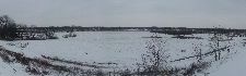
Here's what the grass looks like after the recent snowfall:

This one is standing dead-center in the field looking back up toward where I parked:

Looking Soutwest:

Looking Northeast:

The scrub between the field and the river:

Looking NE again:

And, finally, a panoramic looking back up the hill.

As you can see from this ARIES screen-shot this property is identified as a single parcel and it it owned by the City of Maumee.
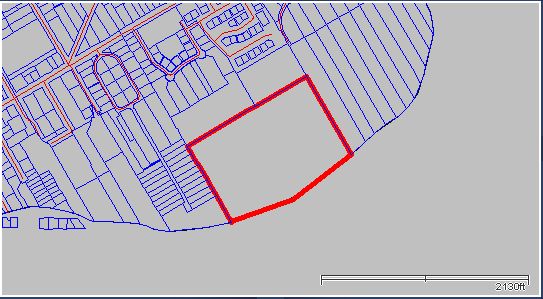 Unfortunately, I don't know if there's a legal way to access that land. There are roads, but I think they're private roads owned by River Commons. Perhaps, this is one of the few rare cases of better to ask permission than beg forgiveness? Or, perhaps there's some rule about landlocked public property? In any case, I think this location is worth a try even if the SW fetch isn't as clean as we might hope.
 |